
Saint Sauveur sur Tinée
67 km from Nice, taking the RN202 to Plan du Var, then the Tinée valley and the Mescla gorges via the D2205.

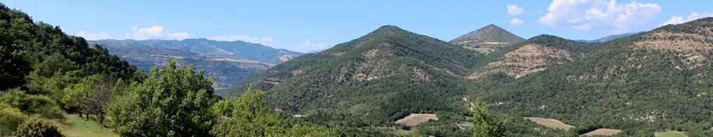
As you emerge from the spectacular red schist Mescla gorges, you will arrive at Saint Sauveur sur Tinée, a large mountain market town located on the edge of the Mercantour National Park, nestling in a bend of the river Tinée.

Saint Sauveur has hidden talents that are not necessarily visible when you just drive through. You won't regret taking the time to visit it at length and will no doubt be charmed by the local red-coloured stone that was used to build most of its old houses, in perfect harmony with the mauve slates of its roofs.
Its recently cobbled medieval streets exude an enchanting atmosphere, climbing and descending, enabling you to discover lovely round fountains, large roofed wash-houses, or a little further on a baroque church with the front painted orange-tinted pink, topped by a slender Romanesque bell tower.

More than half of the village's territory is covered by forest, and so the surrounding landscape is very beautiful.
You can discover it via the way-marked paths, including the famous long distance GR5 and GR 52A footpaths that pass through the area.
What to see
The church of St Michel.
Chapel of Madeleine and St Roch.
ND du Villars, St Blaise.
Leisure activities
Walking and Hiking.
Long distance GR5 and GR 52A footpaths.
Tennis. Fishing.
Accomodations
Hotel.
Hiking gite accommodating 18 people.