Gassin
Last update on
Mar 9, 2026
On road D559, between La Croix Valmer (3 km) and Sainte Maxime (16 km).
On road D559, between La Croix Valmer (3 km) and Sainte Maxime (16 km).
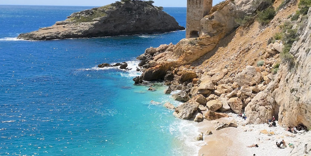
Gassin is located in the middle of the Saint Tropez peninsula, perched on a rocky promontory less than 4 km from the sea. This commune in the Var is one of the Most Beautiful Villages in France.

The village has retained its winding streets and picturesque old houses. You will discover cobbled streets, vaulted passageways, and the Androuno, the narrowest street in the world at 29 centimeters wide.

The Notre-Dame de la Consolation chapel and the fortified church bear witness to the area's historic past. You'll love the medieval heritage and charm of Gassin's town center!

The village's location is quite exceptional: it overlooks a landscape of vineyards, wooded areas, and the Gulf of Saint Tropez! From the terrace of the ramparts, you can enjoy a magnificent view stretching from the Iles d'Or to the snow-capped peaks of the Alps, passing through the Massif des Maures. The view is superb!

On the coast, Port Gassin is emerging as an extension of the existing lakeside resorts: Port Grimaud and the marinas of Cogolin. The Knights Templar left many traces here.
The tourist office offers guided tours to discover the medieval village and its historic center. You can take a stroll through the L'Hardy-Denonain botanical garden, which is home to Mediterranean species.

Tourist activities include visits to vineyards with wine tastings. Throughout the year, various events enliven the town, such as the Saint-Laurent festival in August and summer concerts. If you are visiting Gassin with your family, there are also some great activities for children in the region (boat trips, water parks, etc.).
The events calendar in Gassin offers a wide range of activities throughout the year. In February, the Gassinoise attracts lovers of cross-country running. Spring begins with the Barbecue Festival in early April and the Beer Festival in early May.

Equestrian enthusiasts gather at the Haras de Gassin for international show jumping competitions. Summer brings concerts, night markets, and the Saint-Laurent festival on the second Sunday in August with Provençal events. Cultural activities also include guided tours and theater. Winter ends with the Christmas market and fireworks.
The ramparts, the rectory.
The chapel Notre Dame de la Compassion.
Walks, varied water sports.
18 Hole golf course.
Cyclo-tourism.
This hotel overlooks the calm blue waters of the Gulf of Saint-Tropez
Just a few kilometres from the heart of Saint-Tropez
Mobil home rentals, bungalow 4/8 pers in a campsite 4*
Heated pools - Multisport field - Kid Club - Entertainment - Restaurants
in a 31 acre landscaped park, 5 km from the beach
Camping 4* situated in a 31 acre landscaped park 5 km from the beach
mobil home rental, bungalow 4/8 pers & camping pitches
Heated pools - Multisport field - Kid Club - Entertainment - Restaurants
Hotels
Holiday rentals
Campsites.
You have sent us several questions about the hilltop village of Gassin. Here are our answers to your most frequently asked questions.