Map of Simiane la Rotonde
Tourist map and places to visit in Simiane-la-Rotonde
Looking for the map of Simiane-la-Rotonde? You’ll find ours below. This hilltop village in the Alpes-de-Haute-Provence is tiny. The castle and its rotunda sit at the top, the church and market halls are in the heart of the village, and the parking lots are at the bottom and behind the castle. Our map of Simiane-la-Rotonde shows you all these features at a glance. It also highlights the best places to stay in the village.
How long does it take to visit Simiane-la-Rotonde?
Allow two hours for the main sights. The village has about 600 residents and can be explored entirely on foot. It takes about an hour to walk from the bottom of the village up to the castle.
Add another hour to tour the castle and its rotunda. The combined guided tour of the castle and the village lasts 1 hour and 30 minutes. You’ll need sturdy shoes—the streets are steep.
A half-day is still the most comfortable way to explore. If you’re staying the whole day, continue on to Valsaintes Abbey, 4 km away. The best time to visit? June and July. That’s when the lavender fields around the village are in full bloom.
Where can I download a map of Simiane-la-Rotonde in PDF format?
You can download it directly from this page. Click the “Download Map” button located above, just below our interactive map. The file opens in PDF format.
This map includes the same landmarks as the online map: the castle, the church, the market halls, and the parking lots. Print it before you leave if you’re traveling without a data plan. Cell service can be spotty on the surrounding roads.
You can also save it to your phone. The PDF can be viewed offline without installing an app.
Where is the tourist office located?
The tourist information center is located at the medieval castle, in the upper village. The exact address: Medieval Castle, Upper Village, 04150 Simiane-la-Rotonde, phone 04 92 73 11 34. You’ll find it at the top of the hill, not at the bottom of the village.
This is a branch of the Banon Tourist Office. The staff can provide information about the village and neighboring towns. There you can pick up brochures, maps, and information on accommodations.
This is also where you buy your ticket. The ticket office is located at the castle entrance, and tickets for self-guided tours are available every day. In July and August, the site is open daily from 10:00 a.m. to 6:30 p.m. During the off-season, check the hours before you go.
Where to park in Simiane-la-Rotonde?
Parking can be difficult during peak season. In July and August, spots fill up quickly by mid-morning. Arrive early—before 10:30 a.m.—or in the late afternoon.
Good news: parking is free. All parking lots in Simiane-la-Rotonde are marked on our map on this page.
You have three options:
The Rotonde parking lot, in the upper village, behind the castle. Cars, vans, buses, RVs, and bicycles. This is the closest to the monument.
The Place de la Combe parking lot, in the center of the village. Reserved for cars.
The town hall parking lot on Place René Char, at the bottom of the village. Cars, vans, buses, RVs, and bicycles; equipped with electric charging stations.
If you have trouble walking uphill, park at La Rotonde or Place de la Combe to avoid the steep alleys from the bottom of the village. Everyone else should leave their car at the bottom: that way, you’ll explore the village in the right direction.
What are the must-see sights?
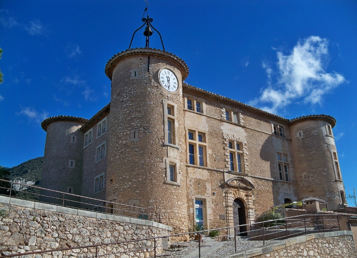
The Rotonde tops the list. It is the former 12th-century keep of the Agoult-Simiane fortified castle. Its truncated conical shape is hexagonal on the outside and dodecagonal on the inside. The great hall features arcades with finely carved capitals, beneath a stone dome with twelve ribbed vaults. The castle has been classified as a Historic Monument since 1841.
Five rooms are open to the public, including two dedicated to aromatic and medicinal plants. An exhibition traces the castle’s history, and an introduction to aromatherapy is offered.
Next, head down to the Church of Sainte-Victoire. Built between 1520 and 1623, it blends several architectural styles and has been designated a Historic Monument since 1922. Its pentagonal choir is what it’s best known for.
The covered market halls are worth a stop. Built at the end of the 16th century, they offer a panoramic view of the valley. In the summer, a café sets up its terrace there.
Also look for the Saint-Jean bell tower. It stands alone, separated from the church to which it was once attached. Partially destroyed by lightning in 1897, it still chimes the hours.
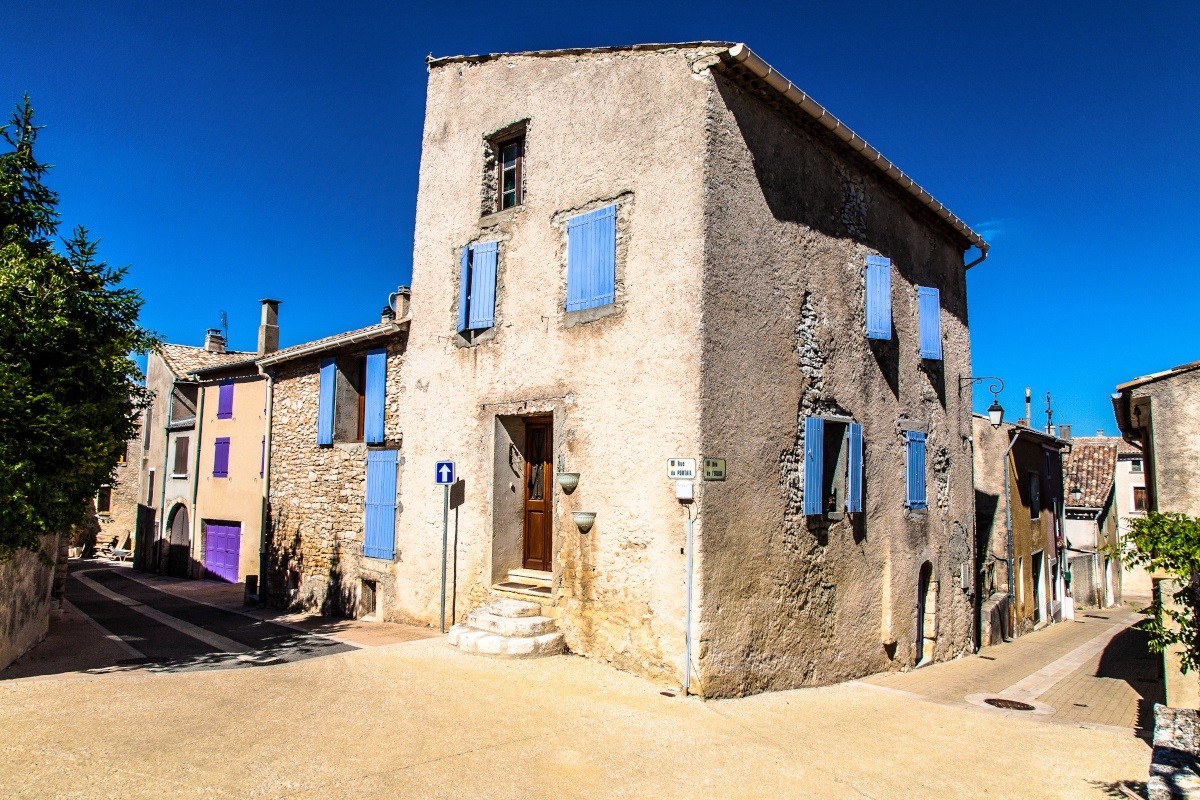
Look up at the facades. The village prospered thanks to the glass industry, and the 16th- and 18th-century homes still feature their mullioned windows and carved stone lintels. Don’t miss the 17th-century gate of the Ostau Montjallard.
Two excursions round out the day. The garden of Valsaintes Abbey, 4 km away, is designated a “Remarkable Garden” and features 550 varieties of roses. And in August, the early music festival Les Riches Heures Musicales de la Rotonde takes over the castle.
How to get to Simiane-la-Rotonde?
Driving is still the easiest option. The village is located on the D51, between Banon in the Alpes-de-Haute-Provence and Apt in the Vaucluse. Allow about 30 minutes from Apt.
If coming from Vaucluse, exit the highway at Avignon Sud and head toward Apt. From Marseille, Aix, or Sisteron, take the A51 and exit at La Brillanne, heading toward Forcalquier, then Banon. The final stretch of the journey follows small, winding roads.
By train, the nearest station is Manosque, about a 50-minute drive away, served by regional trains. For longer trips, head to the TGV stations in Aix-en-Provence or Avignon.
Marseille-Provence Airport is located 100 km away, a little over 1 hour and 30 minutes by car. From the train station or airport, renting a car is highly recommended. The ZOU! bus network serves the area, but the routes are long and involve transfers.
Also worth reading to help you plan your trip: