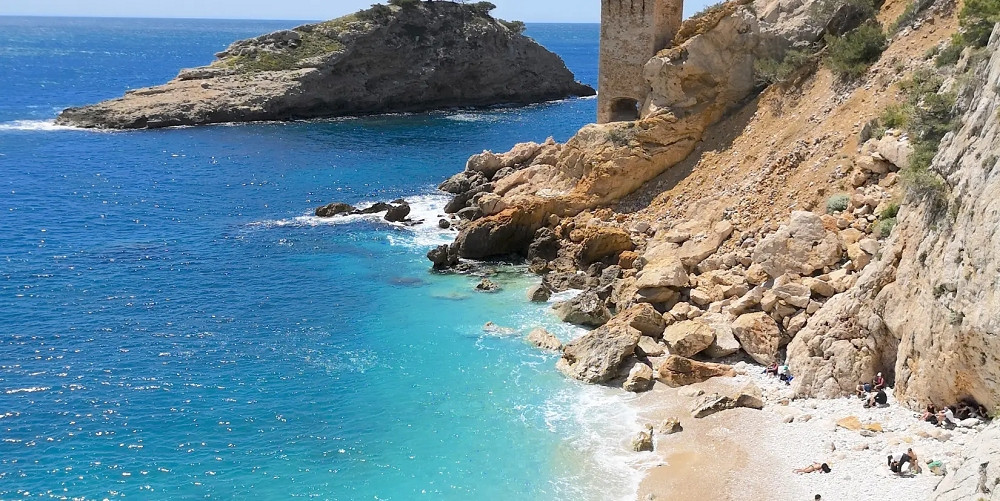
Cavaillon comes to life at the foot of a limestone rock bathed in the golden light of the morning sun. Up above, on the cliffs of Saint-Jacques Hill, a safety line runs along the rock face, high above the town’s rooftops. This is the Cavaillon via ferrata, which opened in 2013 in the heart of the Vaucluse.
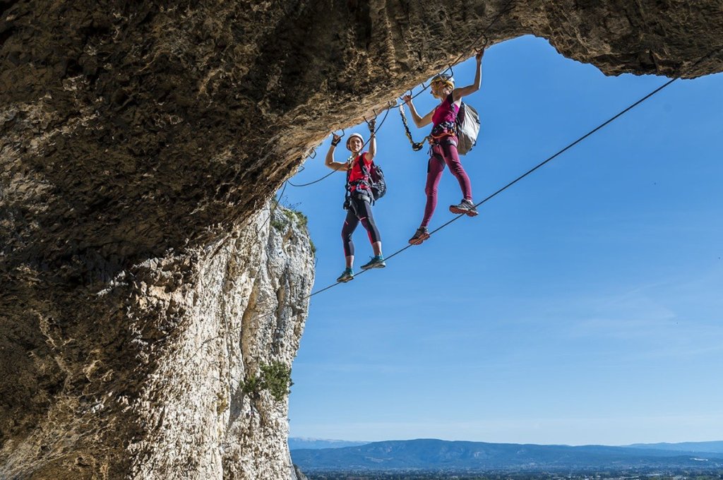
One of its unique features is that you can reach the starting point on foot in just a few minutes from downtown. Two loops await you. The Via Natura is suitable for families, for those 1.30 meters and taller. Its interpretive platforms let you discover the flora and fauna of this natural environment.
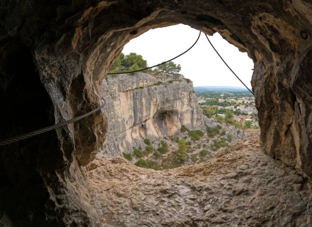
The Via Souterrata is designed for more athletic hikers, with a minimum height requirement of 1.50 meters. The route winds through caves, crosses rope bridges and vertical passages, then delves into underground tunnels. Each route has an escape route.
A cross between rock climbing and hiking, this fun activity reveals the hill’s unique topography. Access is free year-round. At the summit, the view of Cavaillon stretches all the way to Mont Ventoux, the Vaucluse Mountains, and the Luberon. All you have to do is plan your outing.
What are the difficulty levels of via ferrata routes?
Each via ferrata route has a difficulty rating. This rating measures the physical and technical demands of the route. The scale has six levels: F for easy, PD for slightly difficult, AD for fairly difficult, D for difficult, TD for very difficult, and ED for extremely difficult. A “+” or a “–” is sometimes added to refine the rating.
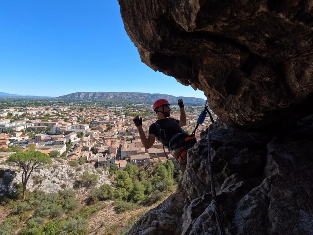
In Cavaillon, the city rates the Via Natura as PD, meaning “not very difficult.” However, some guidebooks rate it as AD, meaning “fairly difficult.” A few sections do indeed put a strain on the arms. Experienced climbers, on the other hand, find it rather easy.
The Via Souterrata is a different story. The city rates it D+, meaning “superior difficulty,” and other guidebooks go as high as TD. Monkey bridges, vertical sections, and underground tunnels require serious physical fitness. You also need to be comfortable with heights.
Keep one simple rule in mind: If you’re a beginner, start with the Via Natura. You can then decide if the second loop is within your capabilities.
Are there routes for families?
The Via Natura was designed as a fun loop. It’s accessible to anyone 1.30 meters tall or taller. For a first family outing, it’s the ideal choice. Nepalese bridges, rungs, beams, and walkways follow one after another over 250 meters.
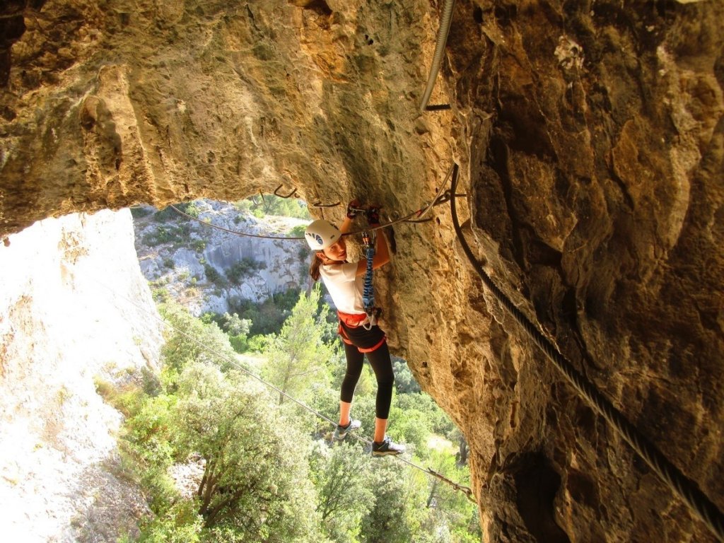
The route is about more than just physical exertion. Interpretive terraces are dotted along the way. Their signs showcase the hill’s flora, fauna, and heritage. Children stop, observe, and then continue on their way.
The minimum height requirement is the only strict rule. Children under 1.30 meters tall are not permitted to participate. Are your teens over 1.50 meters tall? They’ll love exploring the caves along the Via Souterrata.
One detail puts parents’ minds at ease: from the trail, accompanying adults can keep an eye on nearly the entire route. There’s also an escape route that allows you to cut the outing short halfway through.
What are the fees for the via ferrata?
The first pleasant surprise: access is open and free. You don’t pay anything if you bring your own gear. There’s no ticket office and no set opening hours. The site may only be closed due to weather conditions or fire risk.
If you don’t have your own gear, you can rent it in Cavaillon. Expect to pay about 15 euros per person. AB Cycles Outdoor and Cyclix offer this service in town.
Prefer a guided tour? Instructors post clear pricing. The first packages cost around 30 euros about ten years ago. Today, prices start at 35 euros for the Via Natura and go up to 50 euros for both loops, including equipment and insurance.
Booking through an online platform? Be sure to read the terms and conditions carefully: not all packages include free cancellation. For a group or a private outing, request a quote directly.
How long does the via ferrata take?
Allow about 2 hours per loop. The Via Natura stretches 250 meters, and the Via Souterrata 350 meters. Completing both routes therefore takes nearly 4 hours. Add about 20 minutes for the approach walk from the tourist office.
The return trip is quick. It takes about ten minutes to get back down. These times are approximate. Your pace, the number of people on the trail, and your breaks on the terraces can affect them.
The time of day you choose is just as important as the time spent on the route. Facing east and southeast, the cliff face heats up quickly under the morning sun. In summer, set out early or wait for the afternoon shade.
Required equipment
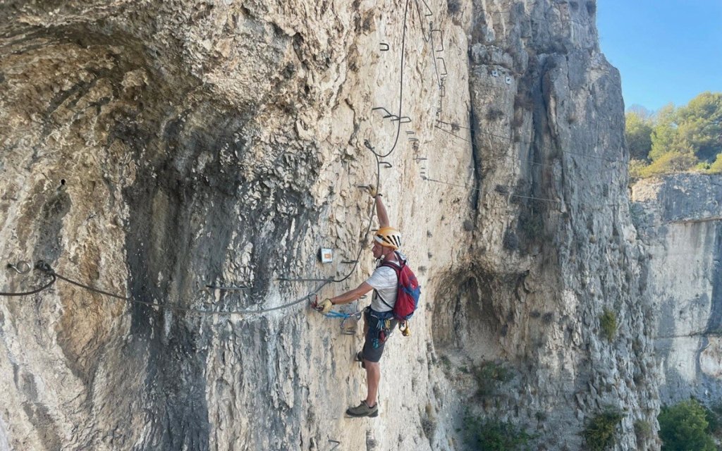
The mandatory gear consists of just a few items. You’ll need a harness, a helmet, and a Y-shaped lanyard with a shock absorber. K-type carabiners complete the set. Gloves and appropriate footwear are also recommended.
This equipment connects you to the lifeline. This steel cable runs the entire length of the rock face. The safety rule is absolute: never unclip yourself from it. Also, check your gear before each outing.
Next, think about comfort. Pack water, a snack, a hat, and sunglasses in your backpack. Instructors recommend one liter of water per person in the summer. Wear pants instead of shorts to protect your legs.
With an instructor, all equipment is provided. Otherwise, renting is the simplest solution.
How do you get to the Cavaillon via ferrata?
This is the site’s biggest draw. The via ferrata is directly accessible on foot from downtown. According to the city of Cavaillon, no other city in Europe offers this level of proximity. It all starts at the foot of the hill, near the tourist office.
Take the stairs to the right of the tourist office, then follow the César de Bus trail uphill. A twenty-minute walk will take you to the starting point on Saint-Jacques Hill. The summit rises to an elevation of 182 meters. The view of Cavaillon opens up as soon as you reach the first switchbacks.
Arriving by car? There’s a parking lot on the hill, accessible via Chemin de Saint-Baldou. If traveling by train, get off at the Cavaillon station. The Zou! buses 907, 908, and 913 also serve the Gare routière–SNCF stop, about 50 minutes from Avignon. Here’s a map to help you locate the via ferrata:
Du 15 juin au 15 septembre, l'accès aux massifs est réglementé selon le risque incendie. Il est interdit en risque rouge ou extrême. Vérifiez les conditions du jour auprès de l'office de tourisme avant de monter.
Quels sont les avis sur la via ferrata de Cavaillon ?
Les avis convergent sur plusieurs points. Les pratiquants saluent d'abord le balisage, très clair à l'aller comme au retour. Ils apprécient aussi l'accès rapide depuis le parking de la colline. Les passages dans les grottes reviennent souvent dans les commentaires, surtout chez les adolescents.
Quelques critiques nuancent le tableau. Un grimpeur aguerri regrette l'abondance de métal et le peu de contact avec le rocher. Le sentier de retour, tout proche, donne parfois l'impression d'un circuit. D'autres notent une sensation de hauteur assez modeste.
Une recommandation revient sans cesse : partez tôt. Une mère raconte que sa fille de 13 ans, pourtant grimpeuse, a peiné sur les passages à la force des bras. Elle conseille d'emporter une longe de repos. L'échappatoire leur a permis d'écourter sans regret.
Au final, l'expérience séduit par son originalité et sa proximité avec la ville. Pour une première via ferrata, elle fait l'unanimité. Consultez les avis et commentaires récents avant de réserver votre moniteur.