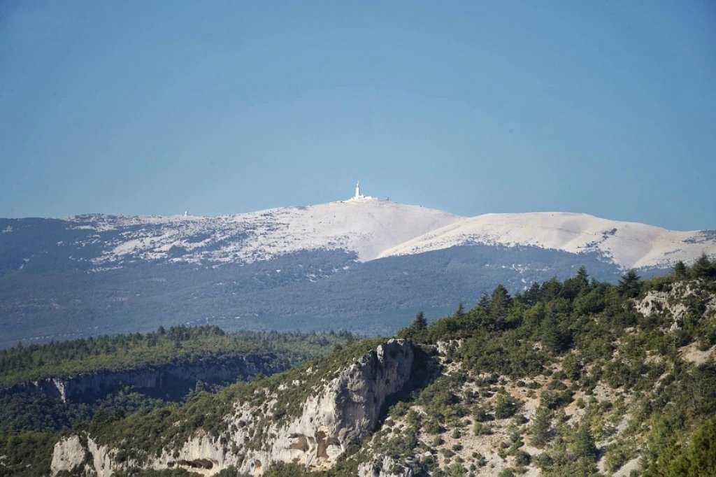
Mont Ventoux comes into view from the Comtat Plain, its white peak rising above the vineyards. As the highest point in the Vaucluse department, it rises to an elevation of 1,910 meters.
You can drive to the summit of Mont Ventoux and park at the Radôme parking lot or at the Col des Tempêtes. From up there, on a clear day, the view stretches from the Dentelles de Montmirail all the way to the Alps.
There are three roads leading to the summit. From the village of Bédoin, the southern slope climbs 21.8 km with an elevation gain of nearly 1,600 meters. The northern slope starts in Malaucène and passes through the Mont Serein ski resort. The gentler route from Sault crosses the plateau of lavender fields before reaching the Chalet Reynard.
In summer, you’ll share the road with cyclists following in the footsteps of the Tour de France. Also keep in mind access conditions: the winter closure blocks the summit from mid-November through spring. You’ll still need to know which route to choose.
How do you get to Mont Ventoux by car?
To reach Mont Ventoux by car, you can choose from three starting points: Bédoin, Malaucène, and Sault. All three routes converge at the summit, at an elevation of 1,910 meters. Each offers a different setting. Your choice will depend on where you’re staying and the atmosphere you’re looking for.
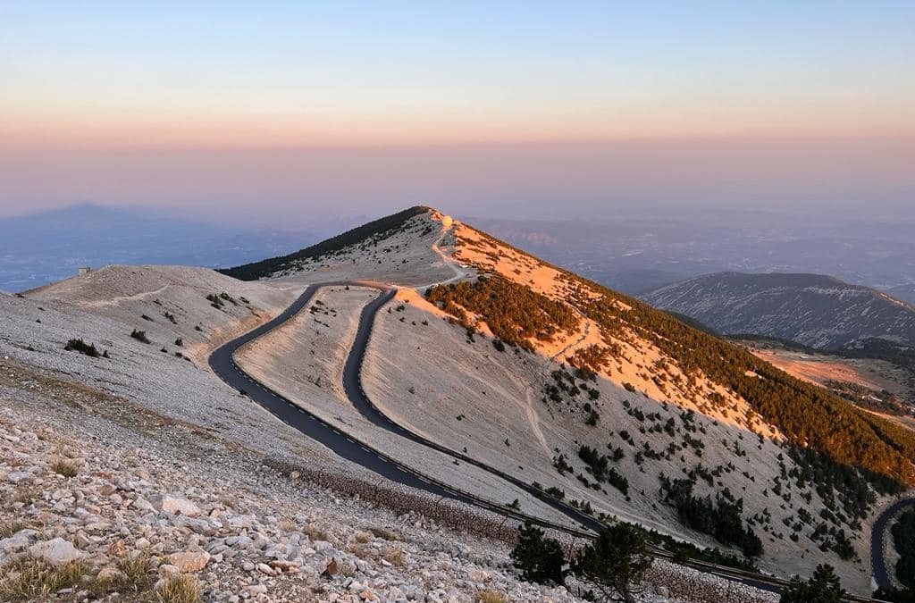
On the southern slope, the D974 leaves Bédoin and winds through the forest to Chalet Reynard. The road then opens up onto a rocky, almost lunar landscape. On the northern slope, the same D974 departs from Malaucène and climbs through the shade of the trees. It passes through the Mont Serein resort before reaching the summit.
From Sault, the D164 climbs gently up to Chalet Reynard. There, it joins the road from Bédoin for the final stretch. This last section is the steepest, regardless of your starting point.
A practical tip before you go: at the summit, parking is only allowed in designated lots. So it’s best to know where to park before you arrive. But first, let’s take a closer look at what each route has in store for you.
And of course, remember to get your car serviced before venturing out onto the mountain roads. No one wants to break down on the climb up Mont Ventoux!
What are the routes to Mont Ventoux?
The routes to Mont Ventoux are all different. Their elevation gain, gradient, and scenery vary greatly.
Here are the three routes to the summit.
Via Bédoin, south face (D974): The route is 21.8 km long with an elevation gain of 1,598 meters. The average gradient is 7.5%, with sections reaching 15%. This is the most famous climb in the Tour de France.
Via Malaucène, north face (D974): This route is 21 km long with an elevation gain of 1,575 meters. The gradient is comparable to that of Bédoin. The route, which is heavily forested, passes through the Mont Serein resort in the town of Beaumont-du-Ventoux.
Via Sault (D164 then D974): This is the longest route, covering 25.6 km with 1,210 meters of elevation gain. The average gradient does not exceed 5%. It joins the Bédoin route at Chalet Reynard.
By car, the route from Sault is the easiest to drive. The route from Bédoin offers the most breathtaking views in its upper section. The route from Malaucène is appealing in summer because of its cool temperatures. Once you’re up there, one very practical question remains: where to leave your car?
Where to park at Mont Ventoux?
At the summit, parking is required in the designated parking lots. The two main ones are the Radôme parking lot and the Col des Tempêtes parking lot. You can also use the designated spots along the D974. Do not stop just anywhere on the shoulder.
From the parking lots, it’s about a 10-minute walk to the summit. The ground is rocky, so be sure to wear sturdy shoes, especially if you’re with children.
In the summer, parking spots fill up quickly around midday. Arrive early in the morning to park without any trouble. You’ll also enjoy softer light on the landscape.
If the summit is too crowded, the Chalet Reynard is a good alternative. It’s located at the intersection of the roads to Bédoin and Sault. There you’ll find a restaurant with a panoramic terrace and several hiking trails. This stop has another advantage: it stays open much longer throughout the year than the summit.
Is Mont Ventoux accessible year-round?
No, the summit of Mont Ventoux is not accessible year-round by car. The road closes every winter, around mid-November. Barriers block access past the Chalet Reynard on the south side and past the Mont Serein resort on the north side. Beyond that point, all vehicles are prohibited, including bicycles.
However, the Chalet Reynard and the Mont Serein resort remain accessible year-round. You can drive up there even in the middle of winter. Parking is available there throughout the season.
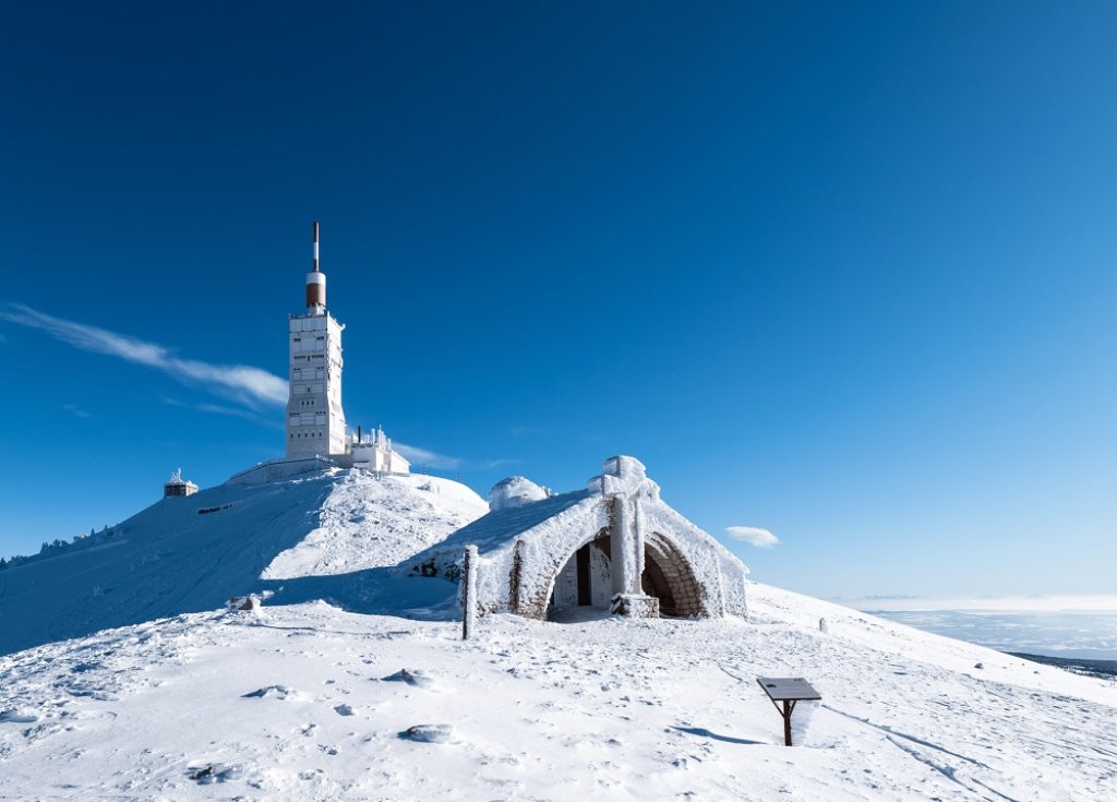
These winter access routes are subject to equipment requirements. The Mountain Law applies from November 1 through March 31. In 2026, a decree issued by the Vaucluse Department extended this period until May 15.
Your car must be equipped with four winter tires marked “3PMSF.” Otherwise, you must have snow chains or snow socks in the trunk. In winter, the Reynard Chalet and Mont Serein offer skiing, sledding, or snowshoeing, depending on snow conditions. To reach the summit itself, however, you need to know the opening dates.
What are the conditions for accessing the summit?
The conditions for accessing the summit depend on the side of the mountain. On the south side, the road reopens around mid-April via Bédoin and Sault. On the north side, it opens around mid-May via Malaucène. In 2026, the southern barrier was raised on April 17 and the northern barrier on May 13.
The road then closes for the winter around mid-November. These dates are approximate; they vary each year depending on snow and weather conditions.
Exceptional closures may also occur during the peak season. The Tour de France, cyclosportives, or trail races sometimes block the road for several hours. Prefectural decrees are published in advance on the Ventoux Provence tourist office website.
Before setting out, check the weather forecast and the summit webcam. Winds can be very strong up there, even when the weather is nice down in the valley. Temperatures also drop significantly with altitude, so be sure to bring a jacket. Once you’ve taken these precautions, the climb becomes a real pleasure, with plenty of places to stop along the way.
What are the points of interest along the route?
The drive up Mont Ventoux isn’t just about the summit. Every road has its own points of interest. Take the time to stop along the way.
Near Malaucène, start by strolling through the village and then head up to its calvary. Further up, the Mont Serein resort is a great spot for a picnic. On the south side, the Tom Simpson memorial stands 1.5 km from the summit. It pays tribute to the British cyclist who died on these slopes during the 1967 Tour de France.
Just below the summit, the Grave road maintenance house is dedicated to the entomologist Jean-Henri Fabre. At the summit, the Sainte-Croix Chapel and the “Les pierres qui parlent” trail round out the experience. The panoramic view stretches 360 degrees.
Via Sault, the road runs past the Ventouret Chapel on the D164. From late June to late July, the lavender fields of the Sault plateau offer a rare spectacle. The Gabelle lookout point on the D1 overlooks the entire Sault valley. The village of Flassan is also worth a detour on the road to Bédoin.
If you have a full day, add the Nesque Gorges to your itinerary. The D942 connects Monieux to Villes-sur-Auzon over 21 km, passing through tunnels and past lookout points. At the Castellaras lookout point, the Rocher du Cire overlooks a 300-meter precipice. These stops take time, so it’s best to plan your travel time carefully.
What are the driving times?
From Carpentras, it takes about 50 minutes by car to reach the summit. The trip is a little over 35 km. Carpentras is a good starting point if you’re staying in the Comtat Plain.
From Bédoin or Malaucène, the drive up takes about 30 minutes. Both villages are located at the foot of Mont Ventoux. The route from Sault is longer in distance but has a gentler incline.
These travel times do not include stops. You’ll surely want to pull over along the way to admire the view. In the summer, you’ll also encounter many cyclists, whom you should pass with caution.
So plan on at least half a day for the round trip, without rushing. If you include the Nesque Gorges or the Sault Plateau, a full day is a must. Setting out early in the morning is still the best option: the light is more beautiful and the road is quieter.