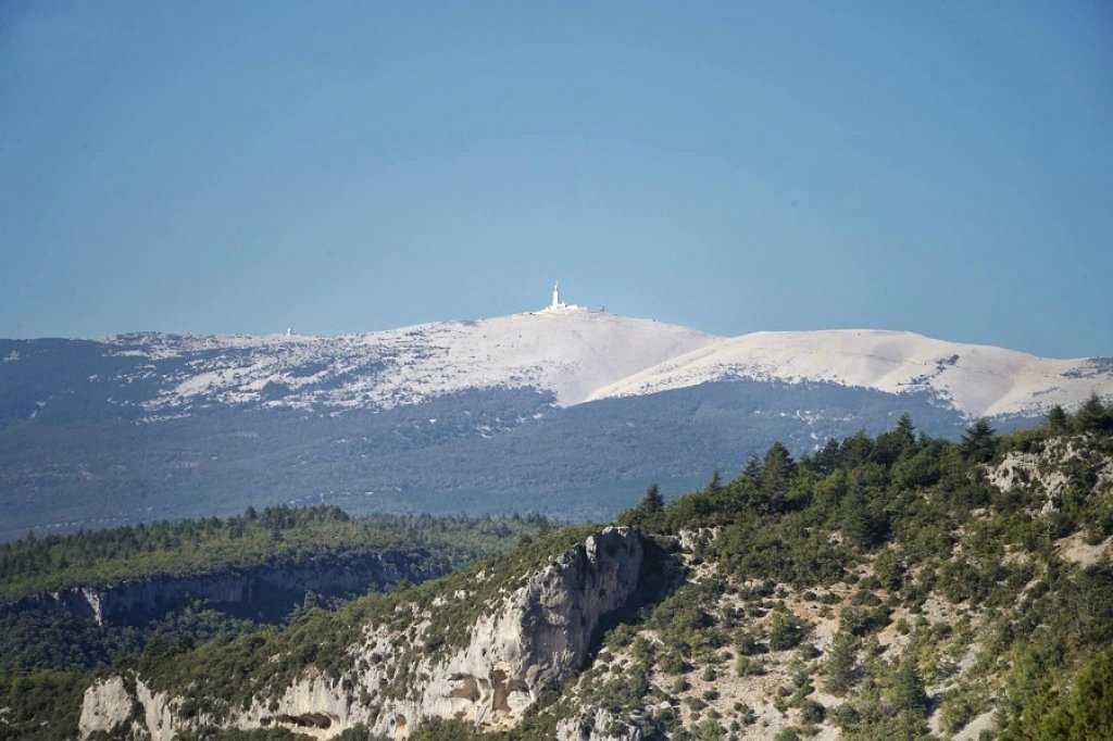
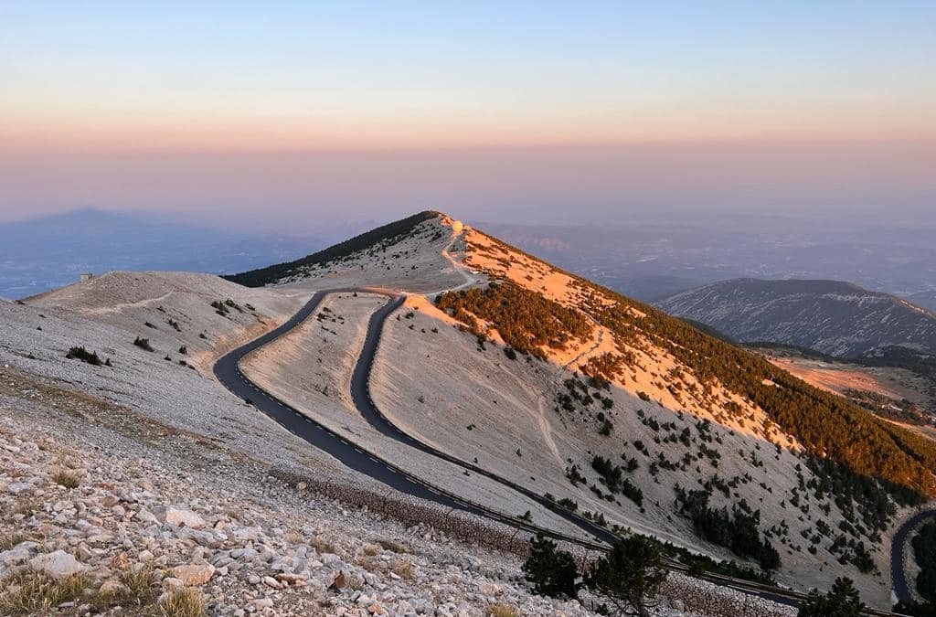
Mont Ventoux is the highest peak in the Vaucluse department, rising to an altitude of 1,910 meters. This legendary summit has two nicknames: the “Giant of Provence” and “Bald Mountain.” Its lunar landscape attracts thousands of visitors every year.
Three roads lead to the top: Bédoin to the south, Malaucène to the north, and Sault to the east. Each route has its own charm. It takes about 30 minutes by car from the foot of the mountain. Cyclists are familiar with these climbs, made famous by the Tour de France.
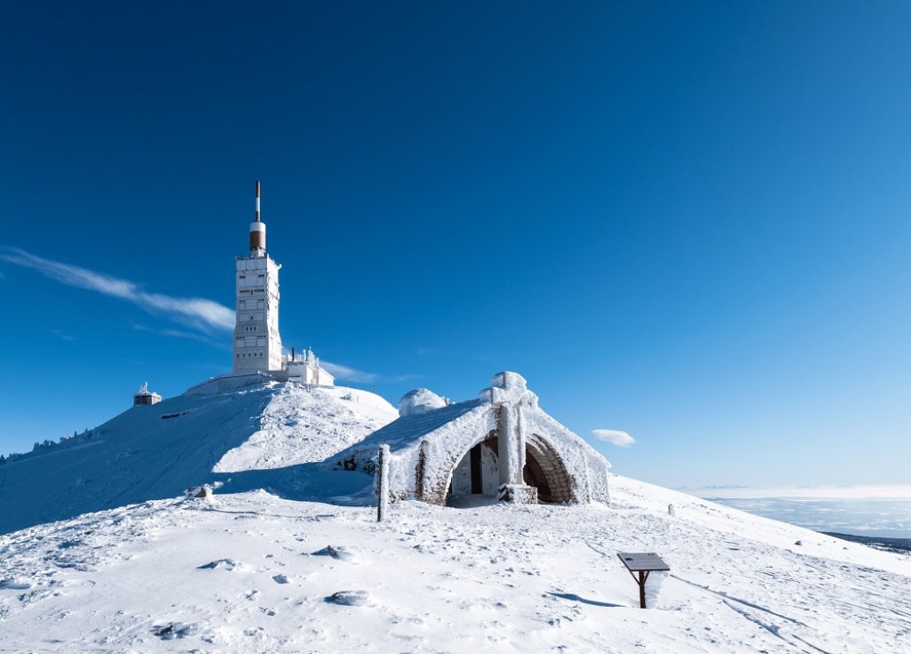
The summit is accessible from mid-April to mid-November. From mid-November onwards, the pass closes for the winter. Snow, wind, and weather conditions make the road impassable. However, the Mont Serein and Chalet Reynard resorts remain open all year round.
This mountain range has been classified as a UNESCO Biosphere Reserve since 1990. The natural environment here is protected and exceptional. Sports enthusiasts love this area: cycling, hiking, trail running, paragliding. Mont Ventoux offers a true mountain experience, sports and escape in the heart of Provence.
How to climb Mont Ventoux?
The ascent of Mont Ventoux from Bédoin is 21.4 kilometers with 1,603 meters of elevation gain. The average gradient is 7.5%. It is the most difficult of the three routes.
Via Malaucène, you will cover 21 kilometers with 1,535 meters of elevation gain. The Mont Serein resort marks the 16th kilometer of this climb. The north side alternates between difficult sections and short breaks.
From Sault, the climb covers 25.6 kilometers with an average gradient of 4.6%. It is the ideal first climb for beginners. The first twelve kilometers are the most difficult, with the 1,000-meter mark to pass. The Reynard chalet is an important stop before the last six kilometers to the summit.
Activities at Mont Ventoux
Ventoux offers over 1,000 kilometers of marked hiking trails. Walks range from one hour to several days of trekking. The regional nature park has been protecting this exceptional natural environment since 2020.
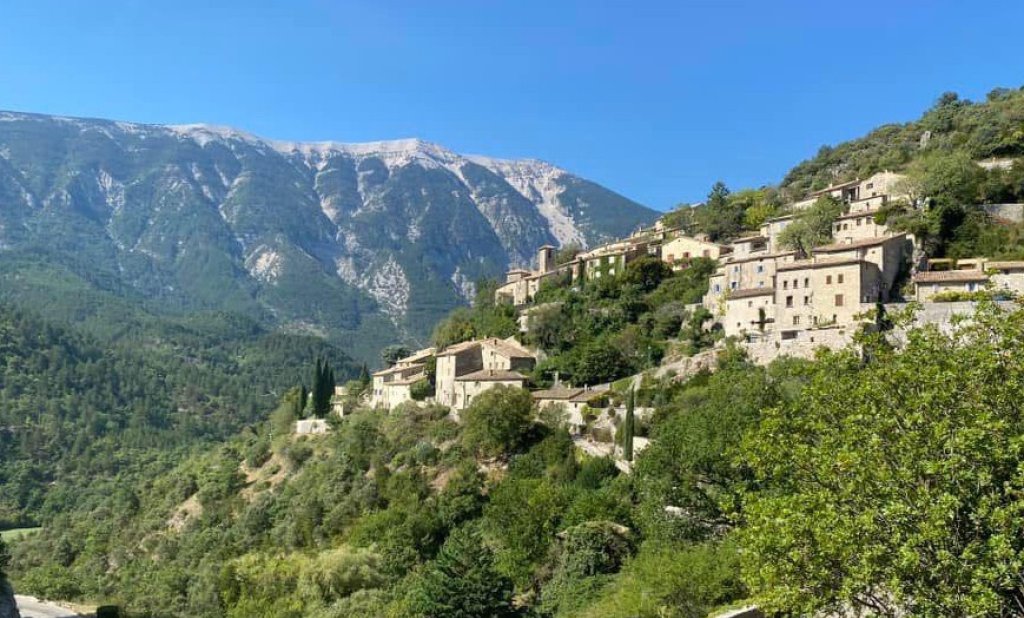
Perched villages such as Venasque, Brantes, and Saint-Léger-du-Ventoux are well worth a visit. Each village has its own charm with its historic monuments and artisans. Tourism is organized around this authentic discovery.
Vine cultivation has benefited from the Ventoux AOC since 1973. Lavender is grown around Sault at an altitude of around 750 meters. This gourmet experience completes the discovery of the region.
In winter, the Mont-Serein resort offers skiing and snowshoeing. In summer, tree climbing and Dévalkart delight thrill seekers. There are activities to suit every season.
The History of Mont Chauve
In the mid-19th century, overgrazing and logging stripped the forests of Ventoux bare. The first photographs show a barren Ventoux. This marked a turning point for the mountain.
In 1858, Jean-Charles Eyraud launched a major reforestation project. This epic undertaking took place from the late 19th century to the early 20th century. These titanic projects transformed the landscape.
Mont Ventoux became the largest communal forest in France, covering 6,300 hectares. A weather observatory was installed at the summit in 1882. It ceased operations at the start of World War I.
In 1990, UNESCO classified the site as a biosphere reserve. It is also classified as a NATURA 2000 area. This natural heritage remains protected and valued today.
When to visit Mont Ventoux?
The best time to visit is from May to September. The climate remains pleasant from April to October. Summer offers the most enjoyable conditions.
Spring offers mild temperatures between 10 and 20°C. The landscapes are in full bloom. It is the ideal season to avoid the oppressive heat.
Autumn combines pleasant temperatures and low visitor numbers. Rainfall is abundant in spring and autumn. Check the weather forecast before you set off.
The summit is closed from mid-November until spring. Mountain law requires special equipment from November 1 to March 31. Visitors are welcome again from mid-April.
Famous challenges linked to the Giant of Provence
The Tour de France has climbed Ventoux 18 times, with 10 finishes at the summit. The climb has been classified as Hors catégorie since 1987. This legendary cycling event fascinates the whole world.
Via Bédoin, it is a 21-kilometer climb with a 1,600-meter elevation gain. The average gradient is 7.5% with sections reaching 11.5%. This difficulty makes it the most formidable slope.
The climbing record was set by Iban Mayo Diez in 2004. The Spaniard reached the summit in 55 minutes and 51 seconds. This sporting challenge attracts thousands of cyclists every year.
The Cinglés du Ventoux climb the mountain three times in one day. They cover more than 137 kilometers with 4,400 meters of elevation gain. This challenge requires excellent physical and mental condition.
Ventoux is the destination for thrill seekers, sports enthusiasts, and nature lovers!
Where exactly is Mont Ventoux located?
Mont Ventoux is located in the department of Vaucluse. It is less than 20 kilometers northeast of Carpentras. It is the highest point in the Vaucluse mountains.
The massif is about 25 kilometers long on an east-west axis. Eleven municipalities share its 26,000 hectares. Its geographical location makes the summit visible from a great distance.
From the summit, the view stretches over the Rhône valley and the Camargue. At its feet lie the Comtat Venaissin plain and the Ventoux hillsides. The Sault region, covered with lavender and unique vineyards, completes this landscape. The superb Nesque Gorges and the Dentelles de Montmirail are also not far away.
Mont Ventoux is located in the Provence-Alpes-Côte d'Azur region. Bédoin is the closest village at the foot of the southern slope. The main access routes are via Malaucène to the north and Sault to the east.