
Map of Lamanon
Tourist map and places to visit in Lamanon
Lamanon appears at the end of a plane-tree-lined avenue, nestled against sandstone cliffs dotted with dozens of caves. On our interactive map of Lamanon, you can see everything you need to know at a glance: the village, the Calès cave dwellings, the giant plane tree, the castle, and the parking lots. The village is small, and everything is within walking distance.
How long does it take to visit Lamanon?
Once you have a map of Lamanon in hand, a question quickly arises: how much time should you set aside? Allow half a day to see the highlights. The village itself can be explored in less than an hour.
The main attraction is the Calès site. Green trail markers guide visitors through the Calès cirque. At the base of the eastern and western cliffs, 58 of the 116 troglodyte caves identified on the site are accessible. Plan on 1.5 to 2 hours to explore them all at a leisurely pace.
Do you enjoy guided tours? The local association organizes them regularly. Allow about 3 hours for this free tour—registration required via HelloAsso—which ends at the Saint-Denis Church in Calès. Closed-toe hiking shoes are required.
In the summer, plan ahead. Be sure to check the day before to confirm that access to the forested area is permitted by prefectural decree. Want to make a full day of it? Add a hike along the nearby ridges. A trail connects Calès to the ruins of Queen Jeanne’s Castle—also known as Roquemartine Castle—with several scenic overlooks along the way.
Where can I download a map of Lamanon in PDF format?
To save time once you’re there, the easiest option is to bring a map of Lamanon with you. You can download it directly from this page. Click the “Download Map” button located above our interactive map. The PDF file will be saved to your phone or computer.
Print it out before you leave if you’d like. It shows the village, the Calès site, the plane tree, and the parking lots. A paper map is still handy on the trails. It also helps conserve your battery life.
For Calès, there’s a useful supplement available. The grocery store in Lamanon sells a small booklet published by the Calès Saint-Denis association. This visitor’s guide costs €8. Hikers recommend picking up a map of the site, as many trails aren’t shown on the IGN map. The association also publishes information on its website, cales-lamanon.fr.
Where is the tourist office?
With a map in hand, you might want some in-person advice. The nearest tourist office is in Salon-de-Provence. Lamanon is 7 km north of Salon on the D538. The drive takes just a few minutes.
The Salon-de-Provence tourist office is located at 71 Place du Général de Gaulle. You can reach them at 04 90 56 27 60. They hold the “Qualité Tourisme” certification. Check the hours at visitsalondeprovence.com before you go.
Once you’re in Lamanon, there’s another organization that knows Calès better than anyone. The Calès-Saint-Denis Association is located at 2, place de l’Église, in Lamanon. The association organizes guided tours of the site. It also sells the visitor guide mentioned above.
Where to Park in Lamanon?
The question remains: where to park your car? During peak season, parking can be difficult in Lamanon. The village is small, and spots fill up quickly on weekends when the weather is nice. All parking lots in Lamanon are marked on our map on this page.
For Calès, aim for the parking lot closest to the site. The association indicates a parking lot 400 m away, at the MTL, next to the fire station. The SNCF train station parking lot also serves as a starting point for walks. You can also park on the church square and continue your visit on foot.
Another free parking lot is located along the Route de la Provence. It’s open year-round, but parking is limited to 1 hour and 30 minutes on school days. Arrive early in the morning during the summer. Never park in front of the barriers on the forest trails: they’re reserved for emergency vehicles.
What are the must-see spots?
Once you’ve parked, it’s time to explore. Most of Lamanon’s attractions are concentrated within a small area. The giant plane tree and the Calès caves are jointly protected by a ministerial decree dated February 26, 1918. Here are the must-see spots to mark on your map:
The Calès cave dwellings. These caves were inhabited from prehistoric times through the 16th century. The site reopened to the public in April 2025 after being closed. There you can see suspension rings, storage silos, drip edges, and beam holes.
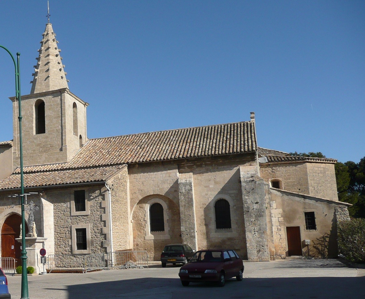
The Church of Saint-Denis in Calès. This Romanesque church dates from the 12th century. It’s located right along the tour route from the caves.
The Chapels of Sainte-Marie and Saint-Jean. These ruined chapels date from the same period.
The Giant of Provence. This plane tree is the village’s star attraction. Two legends circulate about its planting: either around 1658 by Diane de Roux de Lamanon for her daughter’s baptism, or in 1564 by Catherine de’ Medici. It grows on private property, but you can see it from the street, at the intersection of the D23 and the Grand Rue.
Lamanon Castle. The lords of Lamanon left Calès Castle to build a new fortified castle. It comes into view from the driveway leading to the village.
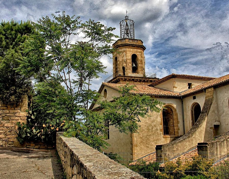
The village church. It was completed in 1783 and restored in 1988. Its tall bell tower is visible from afar.
The castle and the plane tree stand side by side. Calès and its churches form a second cluster, just above the village. Our map will help you visit both without any detours.
How to get to Lamanon?
The village is easy to reach, no matter how you’re traveling. By car, the A7 highway runs very close by. Two interchanges serve Lamanon: Salon-Nord and Sénas. From the Sénas exit, head toward Salon-de-Provence: Lamanon is 5 km away.
Coming from Salon? The village is 7 km north via the D538, and 6 km from Sénas via the same road. There are plenty of signs, and the route is straightforward.
Taking the train is a great option. Lamanon is on the Marseille–Avignon TER line, which passes through Salon and Cavaillon. The Lamanon SNCF train station is right in the village. This way, you’ll avoid the hassle of finding parking in the summer.
Cyclists aren’t left out either. The Alpilles Regional Nature Park offers a gravel loop starting from the train station, through the Durance agricultural plain. Bicycles can be brought aboard TER trains, subject to certain conditions.
Also worth reading to help you plan your stay: