The Blavet Gorges is a red-rock canyon carved into the heart of the Var region, between Bagnols-en-Forêt and La Bouverie, just a stone's throw from Roquebrune-sur-Argens.
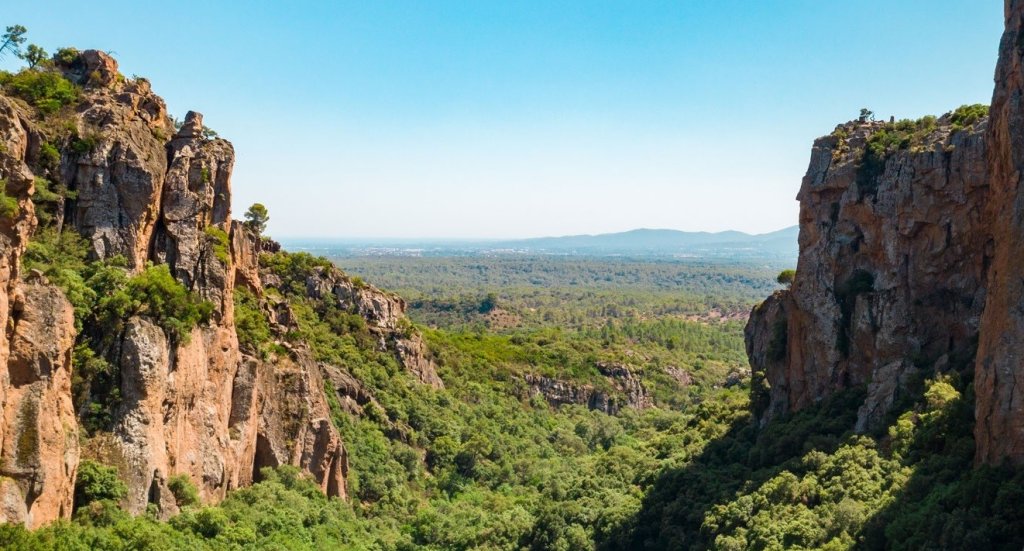
The Blavet, a small river that originates in the hills of the Var, has carved its way through impressive masses of red volcanic rock, shaping a landscape unlike any other. The result? An outdoor destination that combines hiking, rock climbing, and exploring a prehistoric cave, all set against a backdrop reminiscent of Colorado—but in Provence.
The main loop trail covers 3.9 km with an elevation gain of 134 m and is accessible year-round. For more experienced hikers, a 7.4 km loop with 218 m of elevation gain offers a more complete experience of the gorges.
This page provides everything you need to plan your hike: access, parking, routes, difficulty level, recommended gear, and best time of year. Bagnols-en-Forêt is just an hour from Saint-Raphaël and Fréjus. The Blavet Gorges are well worth the detour.
Activities in the Blavet Gorges
The Blavet Gorges offer a variety of outdoor activities in a remarkable natural setting. Hiking remains the favorite activity among visitors, accessible to all skill levels. The site also attracts climbers from around the world, drawn to the red rhyolite cliffs with their unique formations.
Cyclists and mountain bikers can also explore the many trails that wind through the gorges, winding through the valleys and along the ridges of the nearby hills. The Fayence region’s tourist office even offers a 22-km mountain bike loop for seasoned athletes.
The Muéron Cave adds a prehistoric dimension to the outing. At the foot of one of the many cliffs in the Blavet Gorges, you’ll find this prehistoric cave, which was inhabited as far back as 10,000 B.C. From its very wide entrance, it extends deep into the rock. An unforgettable experience that blends nature with human history.
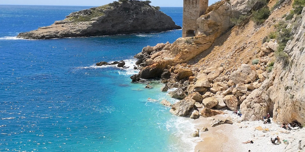
The Blavet Gorges are also close to several other outdoor destinations. You can explore on foot the Maures Mountains, between Hyères and Fréjus, and the Estérel Mountains, between Fréjus and Cannes, for an even broader experience of the region. The Issambres Coastal Trail rounds out a beautiful day by the sea, just a few kilometers to the south.
The best hiking routes
Several hiking trails allow you to explore the Blavet Gorges based on your fitness level and the time you have available. The most popular remains the classic loop starting from the lower parking lot.
The main trail covers 3.9 km with an elevation gain of 134 m and takes about 1 hour and 10 minutes on average. It is an easy route, marked with orange signs, and remains accessible year-round.
For those who want to go further, the “Gorges du Blavet - Piste le Réservoir” loop covers 7.4 km with an elevation gain of 218 m and takes about 2 to 2.5 hours. This moderate trail runs along the gorges for the entire route, offering beautiful views all the way. The overall rating for this route on AllTrails is 4.4 out of 5 based on 219 reviews.
For the more athletic, the “Gorges du Blavet - Pic de Castel Diaou” loop features the greatest elevation gain in the area, with a 480-meter climb. The longest hike available nearby, “La Bouverie - Gorges du Blavet,” is 14.8 km.
This highly rated Visorando route, marked with orange signs, is one of the most popular trails in the Var. Recent hikers have given it five stars for the reliability of the description and the interest of the route.
How difficult are the hikes?
The difficulty varies depending on the route chosen. The Blavet Gorges offer options for all levels, from beginner walkers to experienced hikers.
The 3.9 km route is considered easy, with an elevation gain of 134 m. The trails are clearly marked and the terrain is relatively flat overall. This is a good starting point for a first visit.
However, the ease of following the route is something to watch out for. Several visitors have reported that the markings are sometimes insufficient and have found themselves on trails that are not part of the planned route. Bring a map or a navigation app on your phone to avoid unpleasant surprises.
The classic loop includes two river crossings to cross the Blavet, and a steep, rocky descent near the Muéron Cave. These sections require caution and sturdy footwear, even on a generally easy-to-moderate trail.
The loop should be avoided in rainy weather, particularly due to these river crossings where water flow can vary significantly. Apart from these technical sections, the hike remains accessible to a wide audience, including families with children.
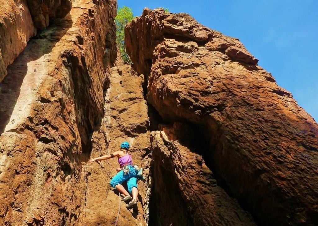
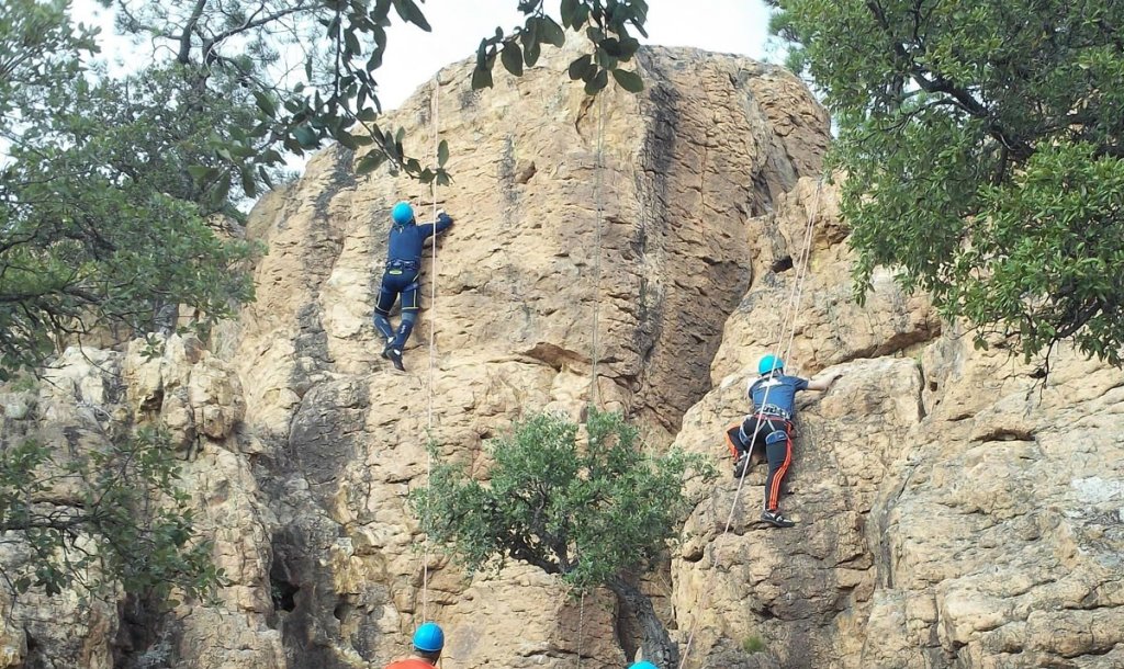
Climbing spots in the Blavet Gorges
The Blavet Gorges are one of the best climbing spots in the Var. The site is renowned far beyond the region, with a steady international following.
The view from the cliffs takes in the Estérel mountains, the Roquebrune and Maures rock formations, the coast of Fréjus and Saint-Raphaël, with the Mediterranean Sea as a backdrop.
The site features 450 bolted routes, ranging from 3a to 8b, and has been offering an alternative to climbers touring the south of France for 30 years. Whether you’re a beginner or an experienced climber, you’ll find a route suited to your level here.
The Colle Rousse sector is the best spot for those trying it for the first time. This small sector offers a dozen routes up to 25 meters high, ranging from 4+ to 6c+.
The rhyolite has a distinctive texture, very different from the limestone that dominates the Var region, and invites climbers to discover new sensations. You can download a guidebook of the climbing routes from the website vertical-evasion.fr, or get started in the sport with a professional guide. The Muéron Cave, at the foot of the cliffs, adds a unique historical context to the climbing experience.
Landscapes to discover
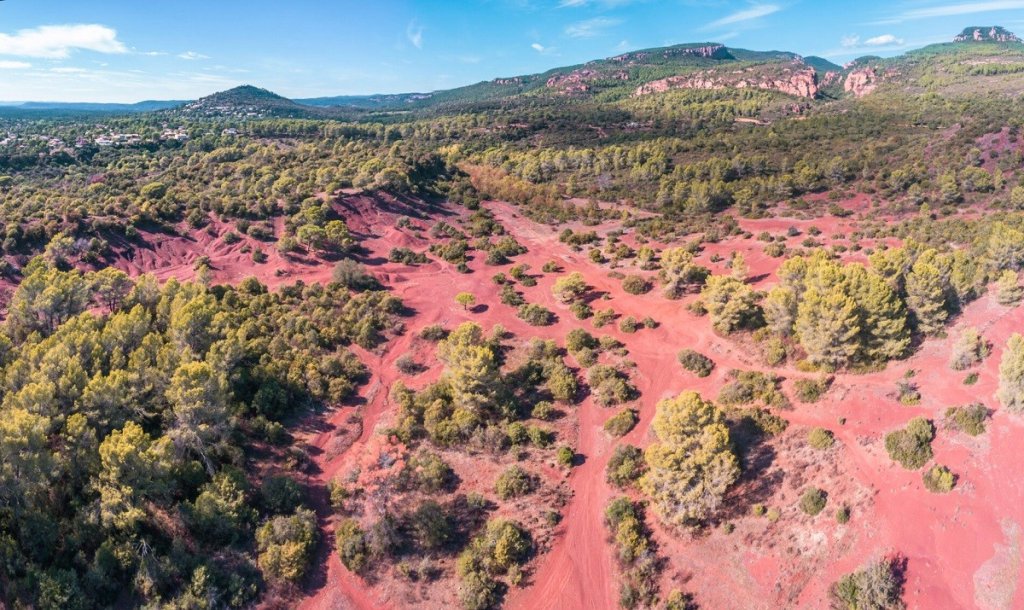
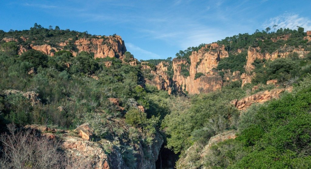
The Blavet Gorges offer landscapes found nowhere else in Provence. The color of the rock is the first thing that catches your eye.
Rich in iron, the cliffs and spires of volcanic porphyry oxidize and take on a golden-red hue. The jagged ridges rise into the sky, changing color with the hours and seasons. Sculpted by water and wind, the rocks take on strange shapes.
The gorge’s colorful landscape gives pride of place to red, but doesn’t forget green and blue. The vegetation, ranging from scrubland to groves, carpets the valley floor and clings to the cliffs in scattered clumps.
Biodiversity is also abundant. You’ll spot birds of prey—peregrine falcons, Bonelli’s eagles—that use the cliffs for nesting, as well as a diverse Mediterranean flora that fills the air with resinous scents from the start of the hike.
The blooming of wild orchids and Helichrysum, visible in April and May, adds an extra touch of color to these already spectacular landscapes. From the orientation table, the view takes in the Roquebrune rock, the Estérel massif, and, on a clear day, the sea in the distance.
How to get to the Blavet Gorges?
Access to the Blavet Gorges is easy from the major cities of the French Riviera. The site is located about 20 minutes from Fréjus, via the D47 departmental road from Bagnols-en-Forêt toward La Motte and Draguignan.
For parking, you have several options: the Gorges du Blavet parking lot at the bottom of the site, the parking lot at the orientation table, and the small “Colle Rousse” parking lot designated for rock climbing. The GPS coordinates for the main starting point are: 43.528869, 6.654967.
Parking is free, but spaces are limited. During peak season, it is advisable to arrive early to avoid having to search for a parking spot.
Several tools are available to help you plan your route. Free interactive maps allow you to follow the trails before and during your hike. For any additional information, the Roquebrune-sur-Argens Tourist Office is your go-to resource: roquebrunesurargens-tourisme.fr. The intermunicipal tourist office of the Pays de Fayence, in Bagnols-en-Forêt, also welcomes you and has detailed trail guides.
When to visit the Blavet Gorges?
The best time to visit the Blavet Gorges is from January to November. The site is open year-round, but each season has its own conditions.
In spring, temperatures are ideal and wildflowers add splashes of color to the red rock. In fall, the atmosphere is milder, the colors are warm, and crowds are much smaller. In winter, it’s completely quiet and the light is golden, but be sure to bring an extra layer.
Summer deserves special attention. From mid-June to late September, access to the Var’s forested areas is subject to restrictions based on the fire risk level, determined daily by the Var prefecture. Before any summer outing, check the map updated daily on the official website: risque-prevention-incendie.fr/var/.
The trail should also be avoided in rainy weather due to the two fords to cross on the Blavet River. The best time to visit is therefore spring and fall: pleasant weather, unrestricted access to the forest, and fewer people on the trails.
If you do come in the summer, set out early in the morning. The heat in the gorges can be intense in the middle of the day, and the parking lot fills up quickly on weekends.