Chorges
Last update on
Feb 9, 2026
Between Gap (19 km) and Embrun (22 km) on the N94 road.
Between Gap (19 km) and Embrun (22 km) on the N94 road.
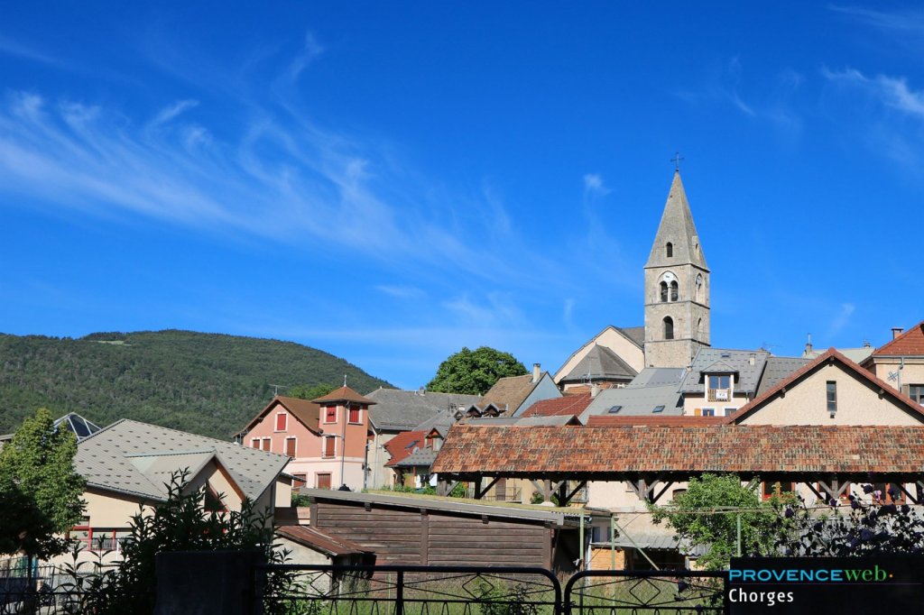
From a distance, Chorges appears to be a large village set against a backdrop of high mountains, squeezed around a handsome Romanesque bell tower. Closer up, you'll learn that the church of Saint Victor dates back to the 12th century, and that the nearby Aiguilles de Chabrières and Mont Colombis rise to an altitude of 2,500 m.
In ancient times, Chorges was a station on the Briançon-Arles Roman road, and capital of the Caturiges. A stele bearing an inscription dedicated to “Nero, prince of youth” remains from this era.
In the Middle Ages, Chorges was surrounded by ramparts flanked by round towers, of which only a few remains today.
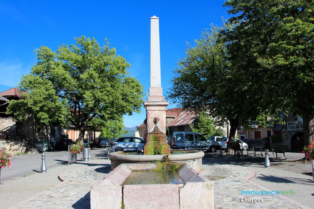
A stroll through the cobbled streets of Chorges will transport you back in time: here you'll admire a round fountain that spits water from the mouths of imaginary but ancient beasts (dated 1548), and there a 16th-century doorway.
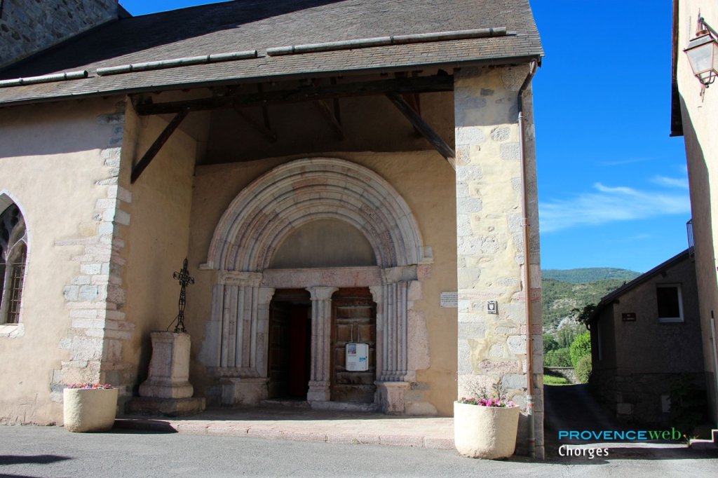
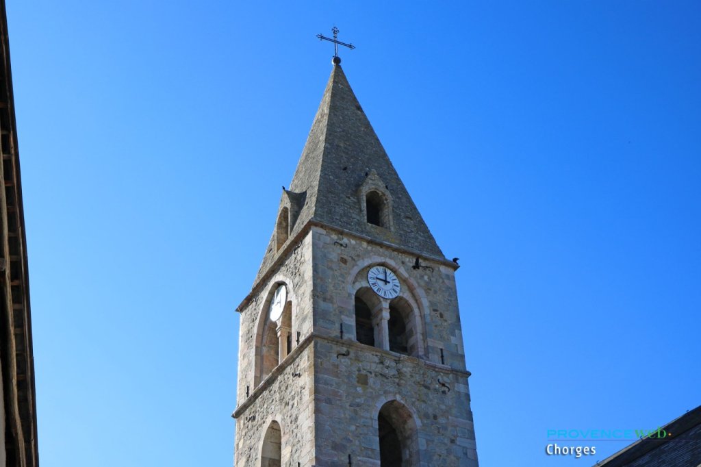
Don't miss Chorges' historic landmark, the shingled-roofed Eglise Saint Victor. Still superb despite its venerable age - 12th century for the primitive church - it was built over several centuries: specialists will recognize a 13th-century door, a 15th-century “flamboyant” window, a 14th-century two-storey bell tower or a Renaissance altar.
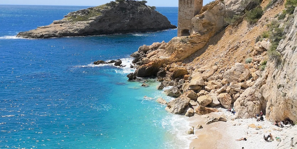
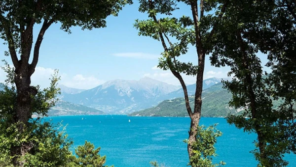
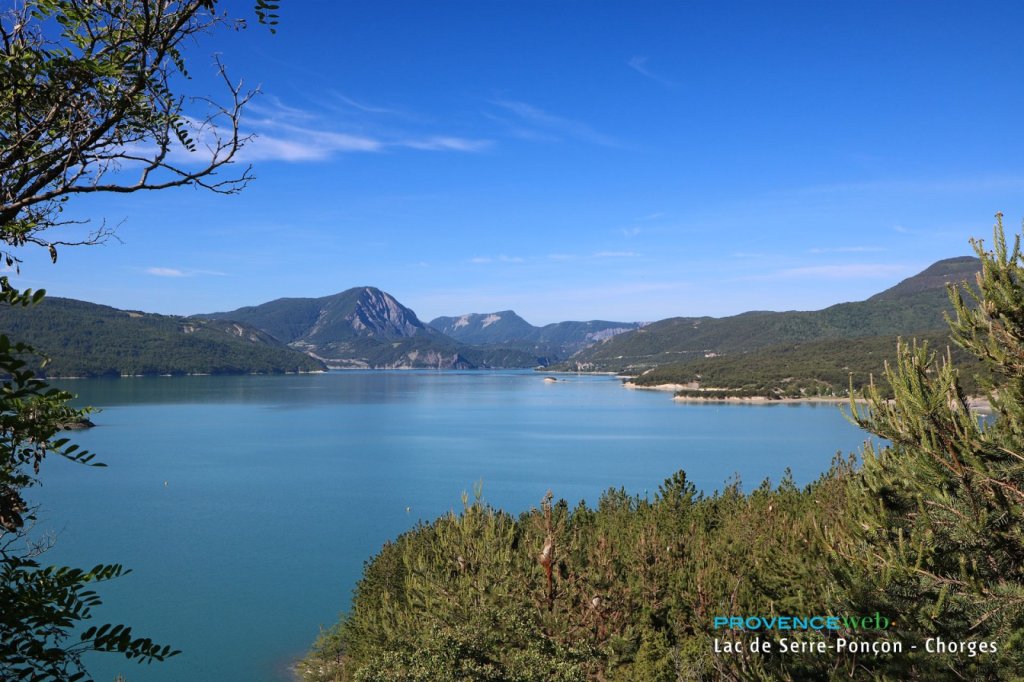
Alongside this rich heritage, Chorges is also fortunate to be located close to the Serre Ponçon lake and at the gateway to the Ecrins National Park. Whether you're a water sports enthusiast or a keen mountaineer, Nature with a capital N awaits you in Chorges!
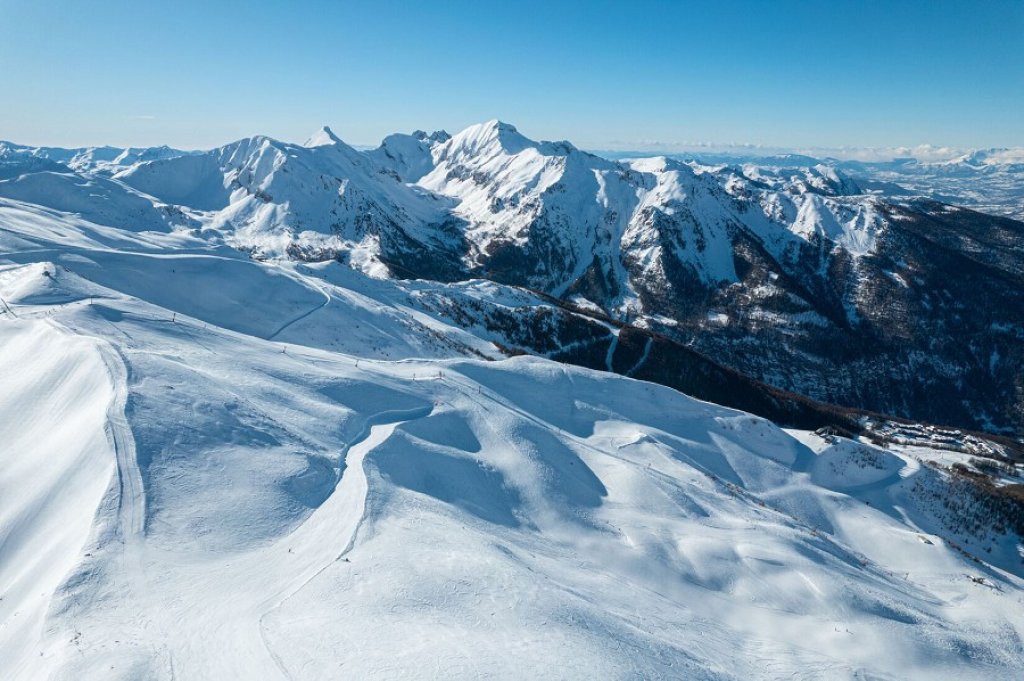
Snow sports enthusiasts will appreciate Chorges' strategic location, just 15 kilometers from two major resorts. The Réallon resort, just 20 minutes away, boasts panoramic slopes overlooking Lake Serre-Ponçon and a family-friendly atmosphere. Les Orres, a 25-minute drive away, offers a larger ski area with 100 kilometers of runs between 1550 and 2720 meters. Its southern exposure guarantees exceptional sunshine all winter long.
To find your way around the commune of Chorges, you can use our interactive map on this page. We've included the village's points of interest (church, town hall, etc.) as well as our recommendations for accommodation in the commune. You'll be able to locate them before booking your vacation in Chorges.
Saint Victor de Marseille 12th century listed church.
In the church is a stele dedicated to Nero.
16th century fountain. Remains of the 14th century defensive walls.
Louis XIII gate originally from the Champoléon chateau.
Muséoscope du Lac (15 km):the story of the largest dam in Europe Serre-Poncon dam, 1959.
Chapels in the hamlets of Les Bernards, Le Villard, Chanteloube, Les Olliviers, Le Fein.
Many different hiking trails and pony-trekking routes.
Mountain-biking Rafting. Via Ferrata.
Fishing. Excursions.
Swimming, nautical sports, sailing and funboard on Serre-Poncon lake.
Pottery market (July).
Village feast day (Sunday after 21st July).
Historical tour of the Caturige settlement.
At the foot of the Réallon Ski Resort - Restaurant
Soundproofed rooms with a simple and modern decor. TV & Wifi
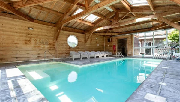
Indoor heated swimming pool - Wellness and fitness centre
Near the Massif des Ecrins and Lake Serre-Ponçon
Spacious rooms for 2 to 5 guests with TV. Some have a mezzanine - Wifi
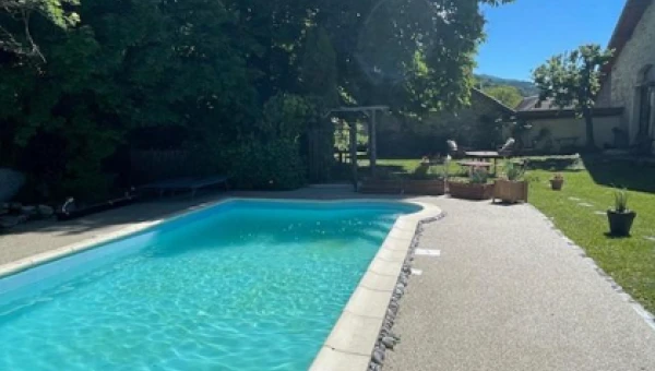
Quiet garden with heated swimming pool - Bar, 24-Hour Front Desk
Residence ideally located on Serre-Ponçon Lake, spacious upscale apartments with exceptional lake views, outdoor pool, private beach, restaurant with panoramic terrace
Attractive chalets, mobile homes and apartments with superb views of Lake Serre Ponçon. 3* lakeside campsite, ideal for water sports, beaches and hiking.
Hotels.
Bed and breakfast.
Holiday rentals.
Campsites.
After writing this guide to Chorges, you sent us several questions. Here are our answers to your most frequently asked questions, so that all our readers can find out more.
Savines le lac (12km), Crots (18km) and Gap (19km).